Geodata and Environmental simulation
Digital Spatial Analysis and Visualization: Geodata and Simulations for the Future
The Geodata and Environmental Simulation department acts as an internal service provider within Müller-BBM Industry Solutions and is available to all other departments for the collection, processing, and analysis of spatial data as well as the simulation of environmental influences. Geodata refers to all types of information that can be linked to a specific location on Earth and is used for various applications such as geographic 3D modeling and visualization. Environmental simulations provide a realistic representation of an area and its relevant factors, enabling the analysis of phenomena such as sound propagation or odor dispersion.
Our Expertise in Geodata and Environmental simulation
Modeling in the Geographic Information System
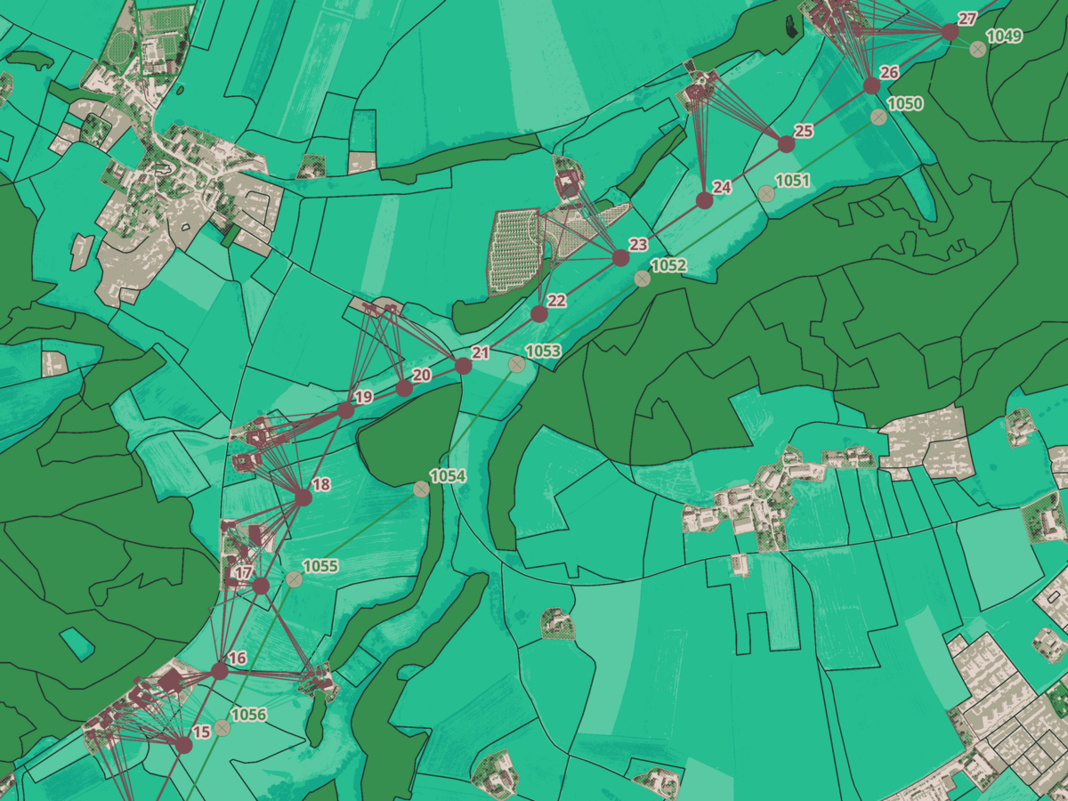
In GIS-based modeling, we create detailed overview maps of project locations across various departments. Through diverse visualization options, we achieve clear and informative representations of complex data.
To do this, data from different sources is transferred, georeferenced, combined, intersected, filtered (SQL), and statistics are generated based on attribute tables. We use a wide range of geoprocessing and geometry tools. Additionally, custom Python scripts (PyGIS) enhance our analytical capabilities and automation potential. For measurements, we provide tailored mobile GIS solutions internally.
Your benefits:
- Spatial data analysis: Georeferencing and geometric operations provide clients with accurate and reliable analyses.
- Efficient data processing: Transferring, intersecting, processing, and filtering datasets enables fast and efficient handling of large data volumes.
- Clear visualization: A variety of visualization options ensure a clear and comprehensible presentation of complex information.
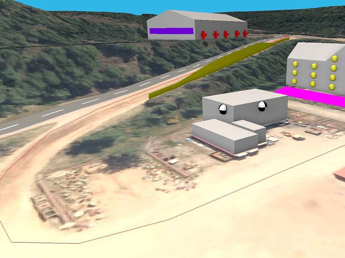
Modeling in CadnaA
We independently create and develop 3D models for sound propagation calculations as well as digital terrain models, primarily using the software CadnaA. In doing so, we manage and compare various planning scenarios, document calculation results, and present simulation outcomes graphically. Additionally, we contribute to quality assurance in connection with noise immission calculations.
Your benefits:
- Precise sound propagation calculations: By using state-of-the-art software like CadnaA, we ensure accurate and reliable results.
- Efficient project execution: Our independent and self-directed working style enables fast and efficient handling of your projects.
- Comprehensive documentation and visualization: We provide detailed documentation and clear graphical representation of simulation results, enhancing traceability and transparency.
CadnaA stands for Computer Aided Noise Abatement. It is a leading software for the calculation, visualization, evaluation, and prediction of environmental noise.