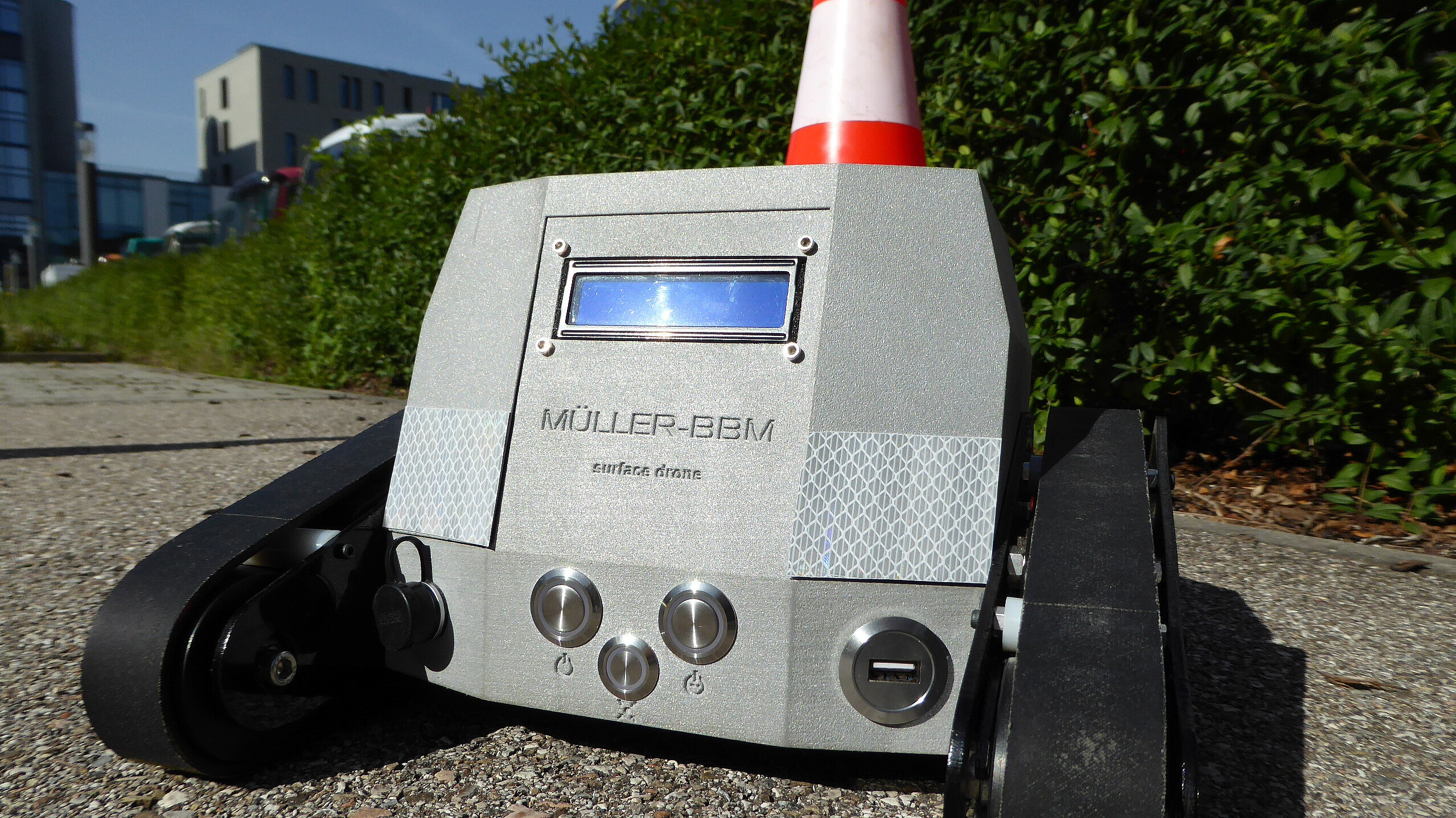
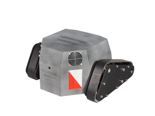
surface drone
Innovative texture measurement system for highest road construction quality
The surface drone is your essential measurement system for continuously assessing the installation quality of road surfaces. It provides precise data on the macro- and megatexture of the pavement to optimize noise reduction, skid resistance, and rolling resistance, and to detect irregularities at an early stage.
Your Benefits
Real-time data display
The LCD screen instantly shows all measurement data, allowing adjustments during installation.
Intuitive operation
The surface drone is easily operated via remote control. One person is sufficient to run the system. Thanks to its internal power supply, it’s ready for use at any time.
Portable and lightweight
Weighing only 4 kg, the surface drone is easy to transport and highly flexible in use.
Versatile application
Whether in road construction or monitoring existing pavements, the surface drone adapts to your requirements.
Self-driving measurement system
The surface drone moves autonomously and captures texture data in real time, even over long distances.
Applications
Macro- and megatexture measurements directly after installation
Monitor the texture of your pavement immediately after installation to ensure quality.
Quality assurance
Assess the evenness of the pavement to secure installation quality.

Long-term monitoring
Identify changes in pavement texture during operation.
Technical data
- Vertical resolution (macrotexture): 2 µm
- Horizontal resolution (macrotexture): 0.1 mm
- Resolution for flatness and inclination: < 0.05° in longitudinal and transverse direction
- Measurement speed: 1 km/h (walking speed)
- Dimensions: 280 mm x 270 mm x 170 mm (L x W x H)
- Weight: 4 kg
Rely on the surface drone for your road projects and ensure the highest quality at every stage of road construction.
Downloads
Do you have any questions?
Feel free to reach out to me!
-
 Maximilian Ertsey-Bayer
+49 (89) 85602-3530 +49 (89) 85602-111 maximilian.ertsey-bayer@mbbm-ind.com Planegg/Munich